South Ribble
Borough and non-metropolitan district in EnglandSouth Ribble is a local government district with borough status in Lancashire, England. Its council is based in Leyland. The borough includes the towns and villages of Penwortham, Leyland, Farington, Farington Moss, Hutton, Longton, Walmer Bridge, Much Hoole, Coupe Green, Samlesbury, Lostock Hall, Walton-le-Dale and Bamber Bridge. Many of the built-up areas in the borough form part of the wider Preston built-up area.
Read article


.jpg)


Top Questions
AI generatedMore questions
Nearby Places
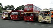
British Commercial Vehicle Museum
Automobile museum in Lancashire, England

Farington
Village in Lancashire, England

Leyland railway station
Railway station in Lancashire, England

Leyland, Lancashire
Town in Lancashire, England
Balshaw's Church of England High School
School in Lancashire, England

County Ground (Leyland)
Football stadium in Lancashire, England

St Andrew's Church, Leyland
Church in Lancashire, England

Wellfield Academy
Community school in Lancashire, England